Clutter / Land Usage
Clutter databases are pixel matrices and contain information about the land usage at a given location. These are also called morpho databases or land usage databases.
Clutter databases are based on pixel matrices. Each pixel defines the class of land usage for a given location (for example the center of the pixel). The finer the grid, the more accurate the database. Today, resolutions (grids) of approximate 5 m to 20 m are used.
Depending on the vendor of the database, the classes of the land usage are defined individually.
For example, class 1 can mean water if the database comes from vendor A. Class 1 can mean forest if the database comes from vendor B.
To handle this data in WinProp an additional table must be defined. In the table, the assignment of the class ID (for example, 1) and the properties of this class (for example, name or electromagnetic properties) are made.
In WinProp, the pixels are always squares (and not rectangles). For example, the resolution (grid) in longitude and latitude are always equal. If the original data use different resolutions for longitude and latitude, the smaller value of the grid is taken during the conversion for both (longitude and latitude), and the undefined values are interpolated (bi-linear interpolation based on neighbor pixels).
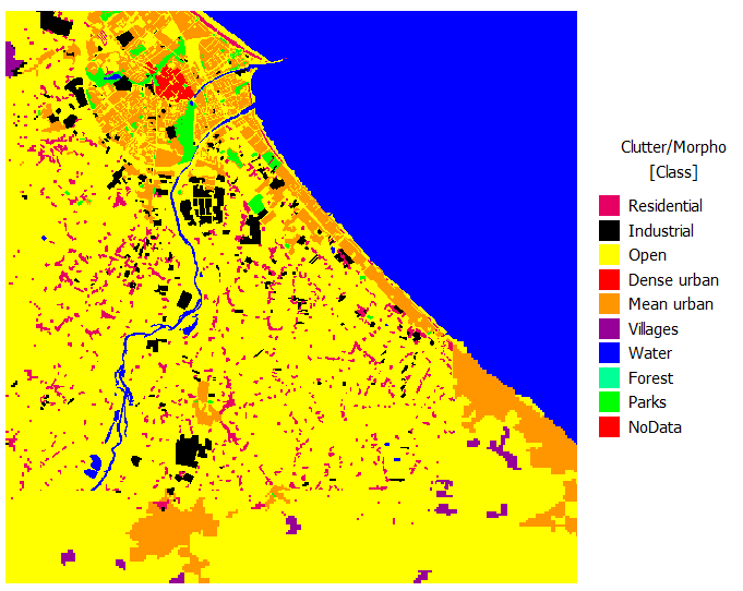
Figure 1. A clutter database of the coast of Rimini (Italy). Different colors are used to indicate different land usage classes.