Modification of the Area Geometry
Modify Geometry of Area
The geometry of a raster database, for example, the database bounds (lower-left corner and
upper-right corner), as well as the resolution, can be changed by clicking ). The following options are available:
- Extract Data
- This option offers the possibility to extract data of a specified sub-area.
This can be useful if a large topography database is resized to keep only the
relevant part of the database.
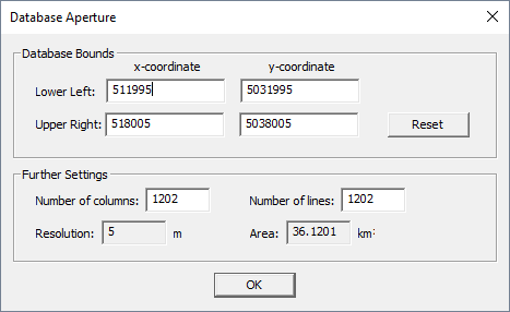
Figure 1. The Database Aperture dialog. - Increase number of columns and lines
- The raster database can be enlarged by increasing the number of columns and /
or lines.
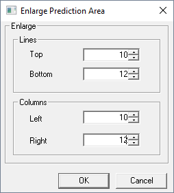
Figure 2. The Enlarge Prediction Area dialog. - Change resolution
- The resolution of the database can be increased or decreased by an arbitrary
factor.
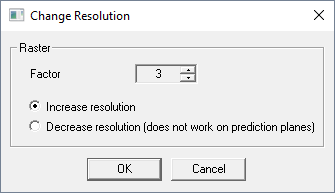
Figure 3. The Change resolution dialog. - Move lower-left corner (move data)
- The entire raster database can be shifted to another location by changing the lower-left corner.
-
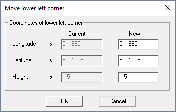
Figure 4. The Move lower-left corner dialog.
Modify Data in Area
To modify data in an area, click . The following options are available:
- Interpolate data
- Missing pixel values can be interpolated from the values of the surrounding pixels.
- Filter data
- Raster data can be filtered with arithmetic or median filter. The order of the
filter can be specified.
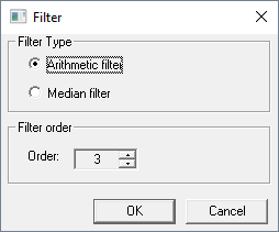
Figure 5. The Filter dialog. - Smooth data
- Pixel data can be beautified by increasing the resolution and applying a filter
afterward. This can be useful for presentation plots. You can specify the raster
factor for increasing the resolution and the filter order.
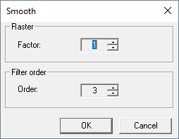
Figure 6. The Smooth dialog. - Delete data
- Selecting this option erases all data contained in the raster database. This means all pixels are set to “not compute”.
- Assign values to pixels to borders
- Pixels at the border of the raster database, which are “not computed” can be padded with the value of the next available pixel value of the same column (for pixels at the top or the bottom) or line (for pixels at the left or right side). This is especially useful if a topography database needs to be extended and no additional data is available.