Export Image File
Export result data to an image file.
- .bmp
- .jpg
- .png
- .gif (not 3D View)
- .tif (not 3D View)

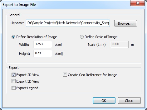
Figure 1. The Export to Image File dialog.
- General
-
- Filename
- Specify a file name to store the image file(s). CoMan automatically suggests a default file name which is created using the path of the current result folder and the name of the current project. By default, the format of the image is bitmap. However this can be changed by selecting another file extension instead of .bmp.
- Export
- The views to be saved to images can be selected in this section.
For the 2D View it is possible to save an additional geo reference file, which offers the possibility to reference the image using real world coordinates.
The content of the 3D View can be exported to an image file as well. However, the file formats are restricted to .bmp, .jpg, and .png.
Alternately, the current Legend View can be exported if it is available.