Export to Google Earth File
Export result data to Google Earth.
Result data shown in the Project View can be exported to Google Earth. To export the content of the 2D View to Google Earth select . After that, a dialog opens, where the export settings can be specified.
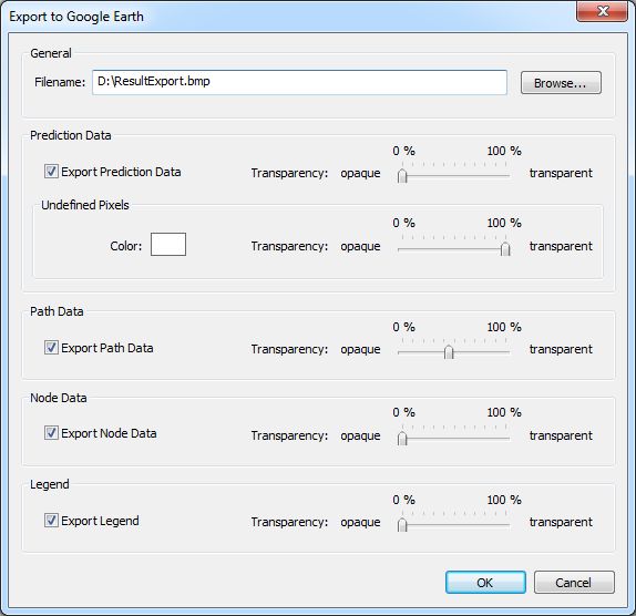
Figure 1. The Export to Google Earth dialog.
- General
-
- Filename
- Specify a file name to store the image file(s) and the Google Earth file. CoMan automatically suggests a default file name, which is created using the path of the current result folder. By default, the format of the images is .bmp. However, this can be changed by selecting another file extension.
- Prediction Data
- Simulation results of area predictions can be exported if available. The transparency of the exported data can be specified arbitrarily between opaque and fully transparent using the slider. Pixels which are not computed can be set to a user defined color. The default color can be changed by clicking on the color rectangle. The transparency of the undefined pixels can be adjusted only if .gif images have been selected for the export format.
- Path Data
- Connectivity path data can be exported optionally if available. The transparency of the exported path data can be specified arbitrarily between opaque and fully transparent using the slider.
- Note Data
- Node locations can be exported optionally if available. The transparency of the exported nodes can be specified arbitrarily between opaque and fully transparent using the slider.
- Legend
- The currently active Legend View can be exported optionally. The transparency of the exported image can be specified arbitrarily between opaque and fully transparent using the slider.