The workflow for a typical rural or suburban simulation is to import the terrain
profile into ProMan, AMan to
produce the antenna pattern and ProMan to simulate the model and
view the results.
For a typical rural or suburban propagation simulation, the work flow is as follows:
WallMan is usually not needed since a terrain profile
is usually generated by a third party and imported directly into ProMan. However, a terrain profile can be imported into
WallMan in special cases.
Use Feko or AMan to
produce the antenna pattern.
For antenna design and simulation, Feko can be used. Feko can
export antenna patterns in .ffe format, which ProMan can import.
AMan is not an antenna simulator. Instead, it is a tool that enables you to produce
an antenna pattern in WinProp format. The pattern may
be converted from another source. AMan can generate
an approximate 3D antenna pattern in cases where only two 2D pattern cuts are
available and can combine antenna patterns to produce that of a base station.
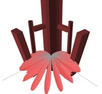
Figure 1. Base station patterns produced in AMan by
combining individual antenna patterns with the geometrical and material
specifications of the base station mounting structure.
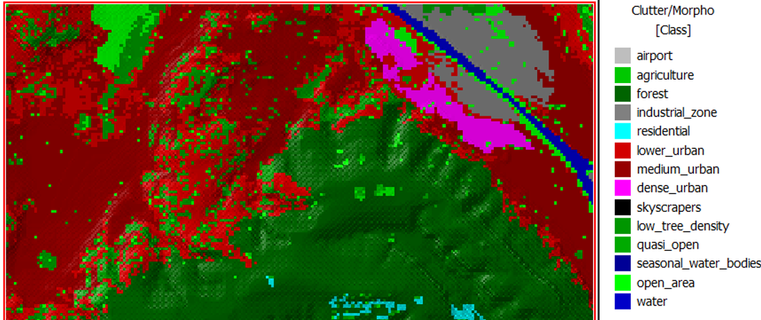
Start a new rural / suburban database in ProMan. Along
with the topology (elevation) database, a land-usage (clutter) database can be
loaded. A topology database specifies the hills while a land-usage database specifies
the kind of surface the signals encounter, for example, forest, fields, water,
sub-urban and buildings.
Figure 2. Example land-usage database, used in addition to an elevation.
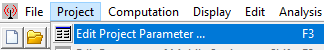
The key menu in ProMan is Project > Edit Project Parameter. This brings up a window with multiple tabs, specific to the
simulation of interest, where many simulation parameters are specified.
Figure 3. The key menu in ProMan is Project > Edit Project Parameter.
In this menu, you also select the simulation method. Several empirical models
are fast but may be less suited for hilly terrain. Basic topological models take the
topology into account. The deterministic two-ray model includes vertical multipath.
The 3D Dominant Path Model is the most rigorous method for pure coverage studies
without multipath effects.
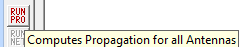
Run the simulation in ProMan through the
Computation menu or by clicking the RUN
PRO button.
Figure 4. Click the RUN PRO button to run the
simulation.
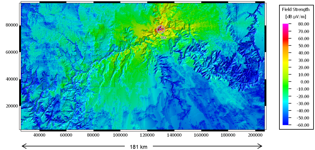
Inspect the results in the same ProMan interface.
Expand the tree on the left if necessary to access the results.
Figure 5. Example coverage results for the Grand Canyon, computed with the dominant
path model. Transmitter power 40 dBm, frequency 948 MHz.