Island of Curacao
Calculate propagation in rural/suburban scenario of the island of Curacao.
Model Type
The geometry is described by topography (elevation) and clutter (land usage). The clutter map, see Figure 1, describes which areas are, for example, residential, water, industrial, dense urban, villages, forest, and no data. The database tree enables you to switch between the topography and clutter displays.
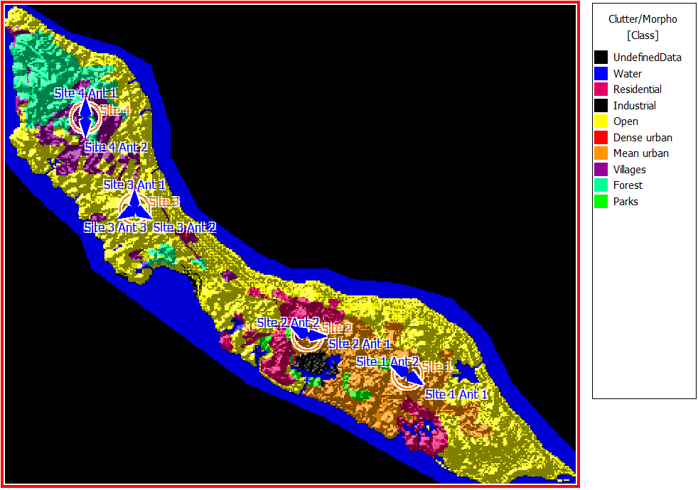
Figure 1. Clutter map for the coastal area.
Sites and Antennas
The model has four antenna sites with two or three sector antennas per site. The horizontal and vertical antenna patterns of the antenna are contained in the Kathrein_739665_0947_X_CO_M45_00T.msi file. All antennas operate at a frequency of 2 GHz. The sites are placed at different locations for the best coverage of the island. In this case, the site locations are specified by latitude and longitude in degrees. The desired resolution of the results is also specified in degrees instead of meters.
Computational Method
Results
Propagation results show the received power by a hypothetical omnidirectional receiving antenna at 1.5 m above ground at every location. For example, Figure 2 shows the results for Site 3 Antenna 3.
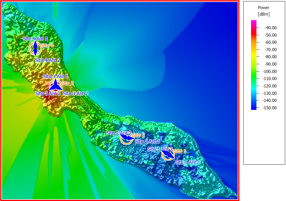
Figure 2. Power results of Site 3 Antenna 3.