Topographical ASCII Database Format (TDA)
Besides the binary format WallMan also supports an open ASCII
data format. Each line of the ASCII file describes a pixel of the elevation data with the
following syntax
:
East (Longitude) North (Latitude) Elevation (Meter)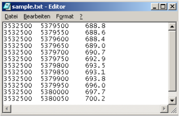
Figure 1. Example of an ASCII topographical database.
East and North can be given either in UTM or geodetic coordinates. The elevation is always defined in meters (or must be converted with a factor to meters). The sequence of the pixels is not relevant (can be in random order).
Decimal values are possible for all values in the file. These ASCII databases can be converted to WinProp’s data format via the menu .
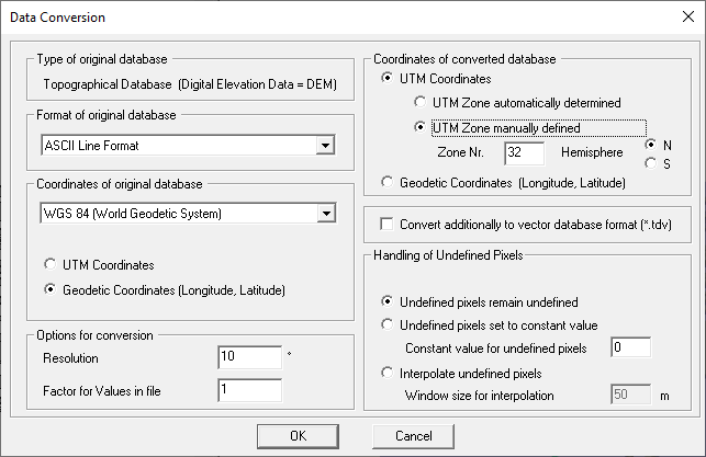
Figure 2. Conversion of ASCII topographical databases to the WinProp format.