Topography
Topography data defines the propagation terrain. It is the most important databases due to its significant influence on propagation.
Topographical Databases
For large scale simulations, topographical databases (DEM = digital elevation models) are the most important databases as the topography has a significant influence on the propagation of electromagnetic waves. The topographical databases are also called terrain databases and are based on pixel matrices. Each pixel defines the topographical height for a given location (for example, the center of the pixel).
As ProMan uses a metric system for the computation, only height values (elevations) in meter are allowed. Other height units (for example feet) must be scaled or converted to meters. In the current version of ProMan the pixels are always squares (and not rectangles), for example, the resolution (grid) in longitude and latitude are always equal. If the original data use different resolutions for longitude and latitude, the smaller value of the grid is taken during the conversion for both (longitude and latitude), and the undefined values are interpolated.
For topographical databases, a single database file has the extension .tdb (topo data binary). The index file has the extension .tdi (topo data index), and it includes the pointers to the small .tdb files. The tdi file is optional. Often .tdb files are used without the corresponding .tdi files.
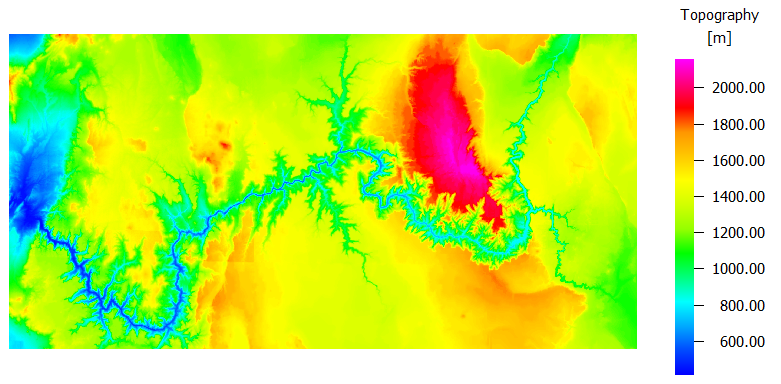
Figure 1. Example of a topographical database - part of the Grand Canyon (USA). Different colors are used to indicate different heights.