Pixel-Based Databases
The consideration of topography might be of importance within urban environments depending on the terrain profile. The topographical databases are very often also called terrain databases and are based on pixel matrices. Each pixel defines the topographical height for a given location (the centre of the pixel). The finer the grid the more accurate the database. Today resolutions (grids) of 20 m and better are used.
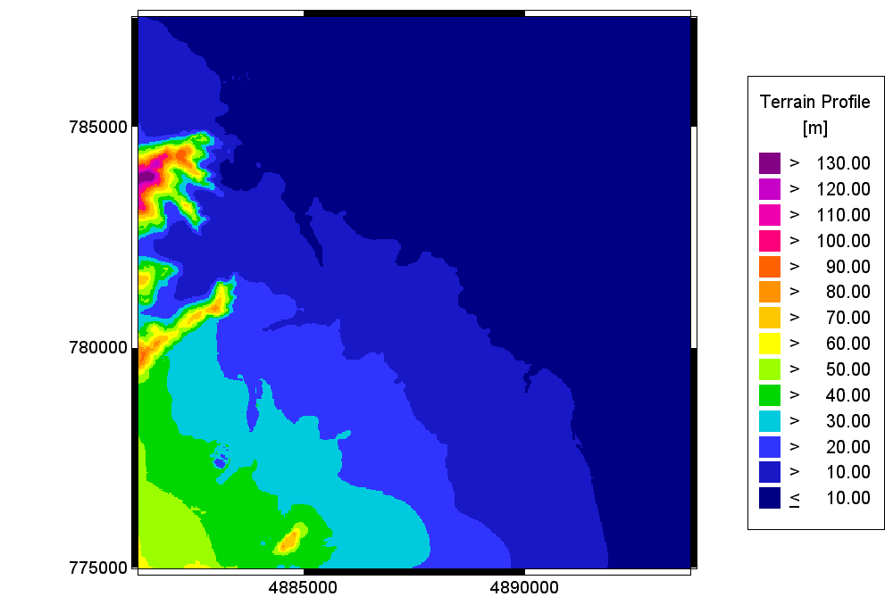
Figure 1. Topographical database (height/elevation).
Currently, WallMan supports only height values (elevations) in metre. Other height units (for example, feet) must be converted to meter and the WinProp format.
In the current version of WallMan the pixels are always squares (and not rectangles), the resolutions in longitude and latitude are always equal. If the original data use different resolutions for longitude and latitude, the smaller value of the grid is taken during the conversion for both (longitude and latitude) and the undefined values are interpolated (bi-linear interpolation based on neighbour pixels).